 Interspect
Urban Development
Townscape, architectural and planning solutions
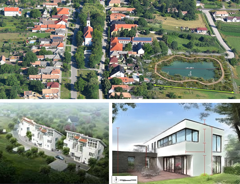
Our Urban Development Tasks
- Collecting maps, establishing consistency among databases and maps
- Geographic Information Systems (GIS)
- Planning and design tasks
- Geodetic and aerial surveys for planning applications
- Preparation of Settlement Character Manuals (Townscape Manuals)
- Facilitating partnership consultations
- Communication among stakeholders
- Presentations
- Website development
Surveying and Planning
The geometry of the city, land cover, and vegetation structures are generated based on images taken from fixed-wing aircraft using calibrated metric cameras, processed with digital photogrammetry. Among the remote sensing products, the point cloud, the derived Digital Surface Model (DSM), the Digital Terrain Model (DTM) established with field qualification, and the orthophoto mosaic are utilized for analysis, providing a stable geometric foundation for the investigations. In justified cases, the process is supplemented with terrestrial laser scanning and UAS-LiDAR surveys.
Data obtained through on-site inspections are also integrated into the resulting GIS database.
The created digital building, vegetation, and visible utility cadastre is applied for solar radiation modeling, urban tree and green cadastre surveys, stormwater accumulation modeling, and public asset cadastre tasks. Several thematic maps are produced for city management; urban and green space analyses are generally followed by the modeling of the mean radiant temperature. We evaluate the number of buildings by type per territorial unit, the built-up ratio of land parcels, the average building height within zones, and the proportion of public spaces in the zone, assessing the significant differences in urban structure and operational characteristics.
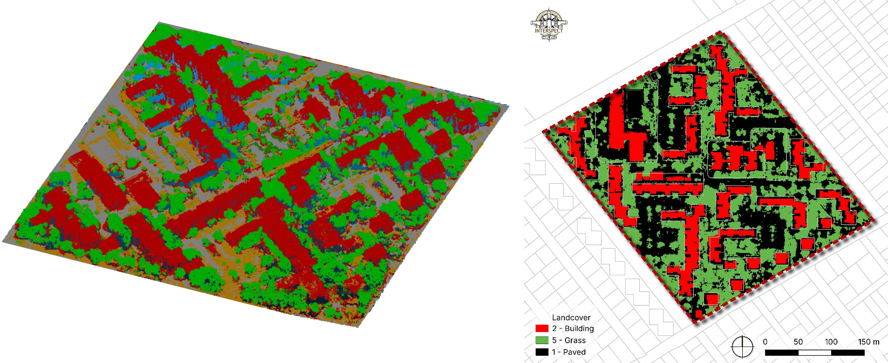 Detail of the classified point cloud and land cover overlay
(Interspect Ltd. Budapest District XVI, 2025)
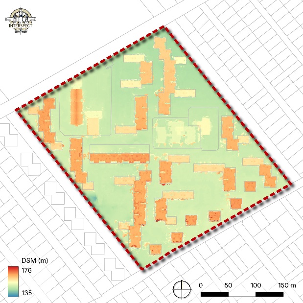 Digital Surface Model (DSM)
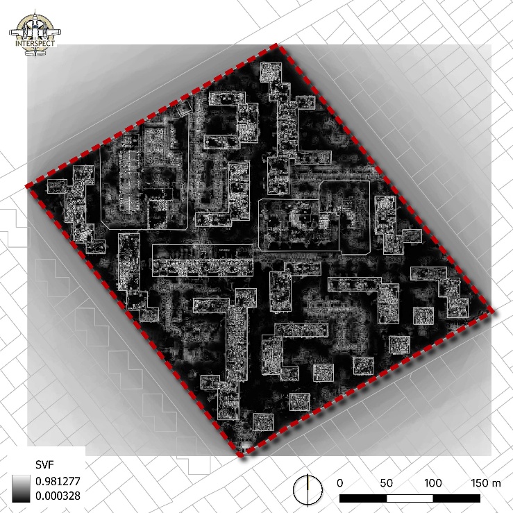 Sky View Factor (SVF) map
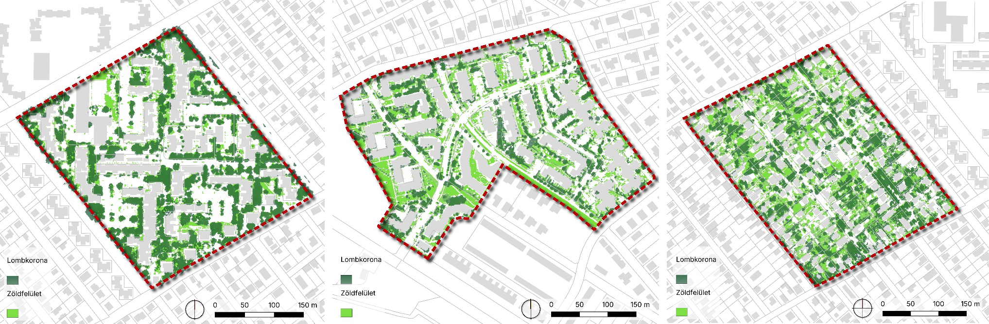 Green surfaces and canopy cover based on a point cloud generated from aerial photography
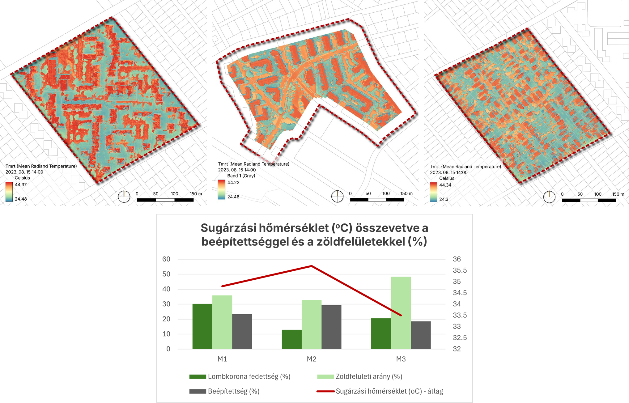 Radiant temperature map overlay and the correlation of values with the proportion of green areas.
(Péter Mandula, Budapest District XVI, 2026)
One of the conclusions drawn from the urban analyses and temperature modeling results is that the parameters defined in the Local Building Regulations (buildability, building height, minimum green area ratio) are often not fully consistent with real, empirical values when examining larger contiguous areas. It is also evident that the parameters of building zones alone do not determine the climate of a district, as certain characteristics (canopy cover, design and maintenance of green areas) vary independently. Therefore, the importance of environmental and nature conservation municipal decrees is increasing. The urban character of districts (e.g., large housing estates, small towns, garden cities) does not clearly reflect the actual climatic characteristics of the area. According to our experience, built-up density, green area ratio, and canopy cover fundamentally determine the evolution of the mean radiant temperature, and with lower built-up density and a high green area ratio, the radiant temperature develops more favorably.
Elevation and land cover data derived from point clouds generated by aerial photogrammetry are suitable for climate modeling, consistent with the methodology already widely applied to LiDAR-based data.
Occasionally, the climate values of certain areas contradict the basic data of the tree and shrub cadastre. The reason for this is that the size of the canopies can individually alter warming, and building heights, while maintaining an adequate airspace ratio, have less influence on warming at street level. Therefore, during decision support, the geometry of the vegetation and the built environment must be thoroughly understood.