 Interspect Ltd.
References and Achievements
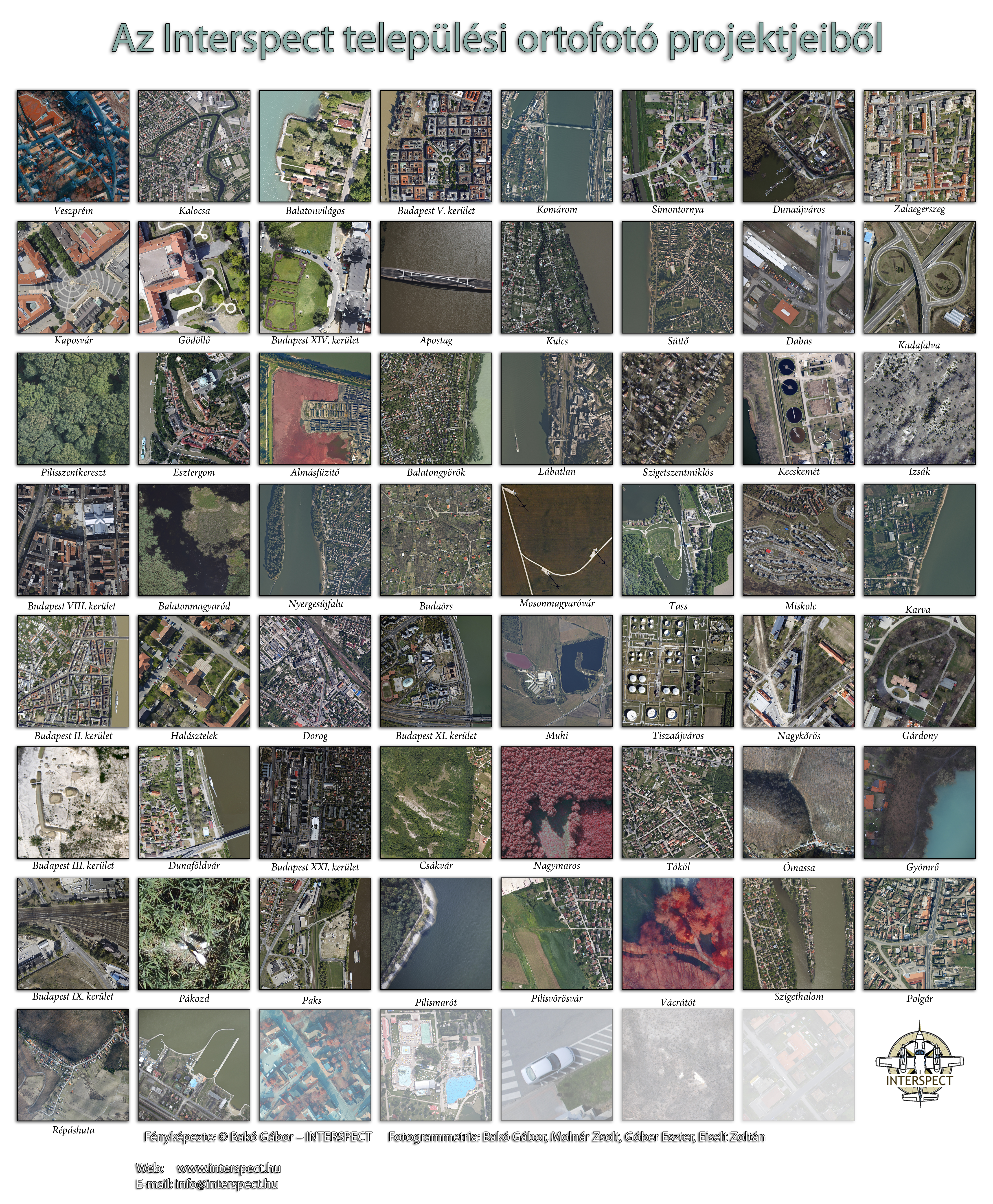
Since 2009, our company has been providing its partners with high quality geospatial data, software solutions, and measurement equipment, integrating state of the art technologies with outstanding professional expertise and uncompromising quality standards.
References and Partners
- Ágfalva
- A-Híd Zrt.
- Aggteleki Nemzeti Park Igazgatóság
- Alpiq Csepel
- Arcanum Adatbázis Kft.
- ATEL Zrt.
- ÁTI-sziget Ipari Park
- Axiál Kft.
- Bácsvíz Zrt.
- Bakonyi Erőmű Zrt.
- Balaton-felvidéki Nemzeti Park Igazgatóság
- Balatongyörök
- Bács-Kiskun Megyei Kormányhivatal
- Biztonságkutató Mérnöki Iroda
- Boldog Gizella Főegyházmegyei Gyűjtemény
- BKK
- BKV Zrt.
- Budakeszi
- Budakeszi Vadaspark
- Budaörs
- Budapest Főváros Önkormányzata
- Budapest Műszaki és Gazdaságtudományi Egyetem
- Budapest III. kerület
- Budapest IV. kerület
- Budapest V. kerület
- Budapest XII. kerület
- Budapest XIII. kerület
- Budapest XIV. kerület
- Budapest XV. kerület
- Budapest XXI. kerület
- Budapest XXII. kerület
- Budapesti Történeti Múzeum
- Budakörnyéki Önkormányzati Társulás
- Bükki Nemzeti Park
- Civertan Grafikai Stúdió
- Colas Északkő Bányászati Kft.
- CompArt Stúdió Kft.
- Cordia
- Csepel Művek
- Debreceni nemzetközi repülőtér (LHDC)
- Delta Systems Kft.
- Diósd
- Dorog
- Dunaföldvár
- Duna Aszfalt Zrt.
- Duna-Ipoly Nemzeti Park Igazgatóság
- Dunakeszi repülőtér
- Duna Múzeum
- Eger
- Eötvös Loránd Tudományegyetem
- Erenfield Consulting Kft.
- Érd
- ÉRV. Északmagyarországi Regionális Vízművek Zrt.
- Észak-magyarországi Vízügyi Igazgatóság
- Esztergom
- Esztergomi repülőtér
- EuroAszfalt Kft.
- Földrajzi Múzeum
- Fővárosi Állat- és Növénykert
- Gábor Dénes Egyetem
- GeoAdat Kft.
- Geodézia Zrt.
- Geoflame Kft.
- GEORT Geotermikus Szondateszt Kft.
- Geosequence Geophysical and Engineering Ltd.
- GEOTOOLS Europe GNSS Kft.
- Google Föld
- Gödöllő
- Gödöllői Botanikus Kert
- Grand Hotel Margit-sziget
- Greenpeace
- Győr Megyei Jogú Város
- GYSEV - Győr–Sopron–Ebenfurti Vasút Zrt.
- Gyulafirátót
- Halásztelek
- Hortobágyi Nemzeti Park Igazgatóság
- Hódút Kft.
- HungaroCAD Informatikai Kft.
- HungaroControl Zrt.
- IMG Solution Kft.
- Infraplan Vasút- és Úttervező Zrt.
- INTERMAP Kft.
- Ipoly Erdő ZRt.
- Kaposvár
- Katonai Emlékpark Pákozd
- Kecskemét
- Kecskemét Vízmű- és Szennyvíztisztító telepek
- KEVIÉP Építőipari és Kereskedelmi Kft.
- Kiskunsági Nemzeti Park Igazgatóság
- Kontúr Csoport Tervező, Építtető, Kivitelező Kereskedelmi Kft.
- Közlekedéstudományi és Építésügyi Minőségellenőrző Intézet
- Közép-dunántúli Vízügyi Igazgatóság (KÖDUVIZIG)
- Közép-Duna-völgyi Vízügyi Igazgatóság
- Kuny Domokos Múzeum
- LAC Holding Zrt.
- Lepsény külterület
- Liszt Ferenc nemzetközi repülőtér (LHBP)
- Loricatus Csoport
- Lővér Fürdő
- Magyar Építészeti Múzeum És Műemlékvédelmi Dokumentációs Központ
- Magyar Földrajzi Múzeum
- Magyar Földtani és Geofizikai Intézet
- Magyar Nemzeti Múzeum
- Mezőgazdasági Gépesítési Intézet
- MindiGIS Térinformatikai Iroda Kft.
- Minerva Várostervező Kft.
- Miskolc
- Miskolci Vízmű
- Mosonmagyaróvár
- MOTORIST CREDIT Kft.
- MTA-SZIE Növényökológiai Kutatócsoport
- MTA Talajtani és Agrokémiai Kutató Intézet
- MTA Ökológiai Kutatóközpont
- Nagykovácsi
- Narmer Építészeti Stúdió Bt.
- Nemzeti Közszolgálati Egyetem
- Nyír-Inzsellér Kft.
- Olajterv
- ORFK
- Országos Vízügyi Főigazgatóság
- Ökológiai Kutatóközpont
- Paks
- Permitto Kft.
- Pécs
- Pilisvörösvár
- Répáshuta
- Robinson étterem
- Roger.Wilco.
- Sidex Trade Kft.
- Simontornya
- STABIL PRODUKT Elektrotechnikai Kft.
- STRABAG Építő Kft.
- STRABAG Vasútépítő Kft.
- Sopron Megyei Jogú Város
- Swietelsky Magyarország Kft.
- S-Technic Mérnök Kft.
- Százhalombatta
- Százhalombattai Régészeti Park
- Széchenyi fürdő
- Szeged Megyei Jogú Város
- Szegedi Közlekedési Társaság
- Szegedi Repülőtér (LHUD)
- Szegedi Tudományegyetem
- Szent István Egyetem
- Szetáv
- Szentendre
- Szigethalom
- Szigetszentmiklós
- Szolnok Megyei Jogú Város
- Szolnok Aszfalt Kft.
- Tiszaújváros
- Tokaj Viridis Kft.
- Tököl
- Tököli repülőtér
- Törökbálint
- TRANS-EUROPE Zrt.
- Vácrátóti Arborétum
- Varinex Informatikai Zrt.
- Vasúttechnika Kft.
- Vasúttörténeti park
- Vértesi Erőmű Zrt.
- Veszprém
- Vízió & Dimenzió Kft.
- VITUKI Kft.
- WWF Magyarország
- VELVER Elektronika Kft.
- VIZITERV Environ Kft.
- Zalaegerszeg
Selected Achievements
On 2 September 2009, between 16:43 and 17:04, we created a perfectly exposed, seamless 1.8 cm spatial resolution orthophoto mosaic of the Budapest Zoo and Botanical Garden from 272 images captured with the IS 1 measuring camera onboard a fixed wing aircraft under low light conditions. The processing of the imagery also required the development of dedicated software, as conventional photogrammetric software solutions at that time were still designed to operate with different image scale parameters.
DetailsFrom 2008 onwards, the Environmental Protection and Water Management Research Institute was gradually dismantled, where ARGOS Studio had operated as the remote sensing department. Since 1972, the national organisation responsible for aerial remote sensing in nature conservation and water management had provided its partners with airborne survey products under various names throughout its history.
DetailsIn two days, we captured aerial imagery of all roundabouts established in Hungary between 2008 and 2010 from a fixed wing aircraft.
The Interspect IS3 was the first calibrated multispectral measuring camera designed and manufactured in Hungary, featuring RGB, NIR1, NIR2, and NIR3 channels.
DetailsCommissioned by the Water Damage Prevention Authority, we produced an orthophoto mosaic, a digital surface model, and a flood inundation model of the affected area using the first Hungarian manufactured multispectral airborne measuring camera, with ground resolutions of 6 and 20 cm. The 3D surface models and maps created by Interspect not only accurately delineated the extent of the inundation but also served as a foundation for restoration and remediation efforts.
Landscape & Environment 9 (1) 2015. 1-11We became the official Central European distributors of Agisoft software products, and during the development of PhotoScan (now Metashape), the company integrated several code contributions proposed by Zsolt Molnár and Gábor Bakó into the software. In addition to products from Blue Marble Geographics and Agisoft, we supplied the police, the defence forces, universities, and companies with our own software solutions.
Our Hungarian website: photoscan.hu > metashape.huUsing the uniform 36 MP RGB + NIR1 + NIR2 + UV spectral channels of the Interspect IS 4 high-resolution multispectral aerial mapping camera, motion-blur-free orthophoto mosaics with a ground sample distance of up to 5 mm can be generated at a ground speed of up to 180 km/h.
RészletekThe orthophoto mosaic depicting the Pákozd Military Memorial Park achieved a 0.5 cm spatial resolution. No one had previously achieved this level of detail from a fast moving aircraft over such a large area while producing a productive, seamlessly extendable photomosaic. The new procedure enabled four times higher ground resolution than the previous airborne imaging record, while maintaining high density orthophoto quality with an RMSE accuracy of 6 cm.
Pákozd on the World's Most Detailed Aerial Map (Orthophoto mosaic)The First Scientific Publication of the Technology
Presentation and practical application of the internally developed octocopter equipped with the Interspect IS U3.1 multispectral spatial camera, as well as the INTERSPECT IS U2.1 5 MP NDVI camera designed for unmanned aerial vehicles and agricultural machinery.
DetailsFollowing the restoration, digitisation, and cataloguing of the glass negatives stored in the Map Collection of the Military History Institute, we continued the project with the Danube river engineering aerial photography map series, vertical aerial imagery of Upper Hungary and Transylvania, and the digitisation of further archival aerial photographs. In February 2014, we published the first digital aerial photography archive (legifelvetelarchivum.hu), which contained not only 25,000 aerial image maps produced between 1916 and 2014 and made available for digital download, but also oblique aerial photographs, water management archives, and aviation history imagery. Thirteen contemporary aerial photographers joined the initiative, enabling extensive coverage of Hungary.
The First Hungarian Digital Orthophoto ArchiveUsing our in-house developed aerial thermal mapping camera, we located the underwater thermal springs along the Budapest section of the Danube. During the night flight, a high sensitivity (ISO 36,000) RGB orthophoto mosaic was also produced simultaneously with the thermal imagery, ensuring the geometric accuracy of the jointly processed thermal map. First official publication: Bakó G., Molnár Zs., Páll-Somogyi K., et al. Surveying the drowned springs of the former Fürdő Island in the Danube by high resolution airborne remote sensing. J Environ Geol. 2020;4(1):1-6.
In Hungary, Interspect Ltd. was the first company to perform the remote sensing, geodetic, and geoinformatics tasks of eTOD (Electronic Terrain and Obstacle Data Collection) as defined by ICAO Annex 15.
Complex solutionWe acquired and georeferenced the CORONA reconnaissance satellite imagery recorded on film in the 1960s, creating and making publicly available Hungary’s 2.5 m ground resolution historical photomap from the 1960s. Eleven specialists from our 12 person company worked on the project for six months. CORONA was the United States’ first reconnaissance satellite programme. The exposed film images were recovered by aircraft after re-entering the atmosphere. The Interspect Ltd. team processed the imagery, which had remained classified by the CIA until 1995, within six months and transferred the dataset to Arcanum Database Ltd. for free public access. As a result, Hungary’s landscape as it appeared in the 1960s became freely accessible and searchable for everyone.
Brief Description of the ProjectAccess to the Imagery
The Interspect IS 5 combines the advantages of high-resolution multispectral, hyperspectral, and penta mapping cameras. Out of its seven 50 MP camera heads, motion-blur-free orthophoto mosaics with a ground sample distance of up to 4 mm can be generated using the downward-facing RGB + NIR1 + NIR2 + UV spectral channels at a terrain-relative flight speed of up to 180 km/h, while the geometric quality of the 3D model is ensured by 20-degree tilted cameras, and hyperspectral data collection is provided by a diode sensor.
DetailsWe develop the network to support the monitoring of ecosystem services provided by natural and landscape values, near natural and anthropogenic areas, to improve the understanding of the impacts, temporal dynamics, and spatial distribution of harmful processes, to analyse the effectiveness of management interventions, and to support sustainability assessments of agricultural areas and model farms.
Scientific PublicationIn cooperation with Greenpeace Hungary (the “Our Poisoned Heritage” initiative, which aims to identify and document contaminated sites in Hungary and promote the implementation of necessary remediation measures) and the Ministry of Agriculture, we mapped the areas affected by contamination based on available data, satellite imagery, and aerial photographs.
A nyilvánosságra hozható helyszínek eléréseBased on the photogrammetric and visual interpretation reconstruction of archival glass negatives, we generated milling paths for the restoration of the numerous wooden decorative elements of the ceremonial hall, which was destroyed by fire during the Second World War.
Several Simplified 3D Models for Online PresentationThe Interspect Walker fixed wing UAS, developed for high speed passive optical aerial surveys, was first presented at the FJD demonstration day.
One of the Demonstration Flights of the Interspect Walker (video)Using our own methodology, we surveyed the most important technical elements required for industrial railway infrastructure assessment and database integration, combining airborne and terrestrial measurements. We were commissioned for Phase 3 of the VIKI project to localise the designated railway tracks and perform geometric verification. We produced high resolution orthophoto mosaics of the track surroundings, as well as vector based geospatial maps of static railway technical installations, rail lines, and related observations (such as vegetation coverage, buried rails, and other relevant conditions) suitable for integration into geographic information systems. The generated data were also implemented in RINF XML format. Aerial video recordings were captured for every surveyed section.
The Interspect Group is a member of the Szeged Water Guardians group, both as a supporter and an active participant. We are proud of the successful water retention initiatives implemented in Kiskundorozsma.
ReportIn 2024–2025, at the request of the experts of HNPI, we developed a methodology for the automated detection and mapping of blind mole rat mound chains, as well as a survey methodology for the collection of environmental data and the integrated analysis of vegetation, land cover, land use, exposure, water affected areas, and drying surfaces.
Scientific PublicationThe History of the Interspect Group
The Interspect team of young researchers and engineers was not established at the same time as the company itself. Our team was formed as an association in 2004, providing audiovisual services, airborne remote sensing, and later environmental monitoring and environmental condition assessment in support of landscape based environmental protection. This was made possible because the association's members, many of whom were also involved in higher education, primarily came from the Environmental Protection and Water Management Research Institute, Szent István University, and Eötvös Loránd University. They possess extensive expertise in environmental engineering, water and forest management, urban planning, and disaster management, for which they collect and analyse spatial information.
With the growing emphasis on remote sensing, research and development, Interspect Ltd. was established in 2009. Within just a few years, the company became Hungary's leading centre for the development of airborne remote sensing sensors and a key player in the national airborne remote sensing sector. Interspect Ltd. experienced rapid growth and achieved significant technological breakthroughs within its first two years of operation. The successful introduction of our technology in September 2009 led to the development of numerous camera system variants. Our accumulated professional expertise, combined with continuous consultation and innovation, has enabled the production of unique, high performance photogrammetric and remote sensing products. Beyond delivering high spatial resolution, our professionally processed multispectral imagery provides enhanced dynamic range and offers new opportunities for information acquisition, enabling more detailed interpretation and more reliable classification. In addition to ground sampling distance, positional accuracy is a fundamental factor determining the reliability of thematic maps and geospatial databases derived from remotely sensed data. With these principles in mind, we remain committed to maintaining the high standard of quality that has become synonymous with Interspect products.