
Water retention, flood, and inland excess water status assessment and modeling using high-resolution digital terrain models
Since its inception, our company has been a supporter and active participant in lowland water retention projects. The project summary compiled in cooperation with the Szeged Water Guardians is available here: Szeged Water Guardians Öreghegy pilot project v4.3
Airborne remote sensing surveys of river environments conducted during low-flow conditions provide a detailed digital surface model that serves as a foundation for generating flood inundation models. This enables the simulation of flooded areas at specific discharge levels.
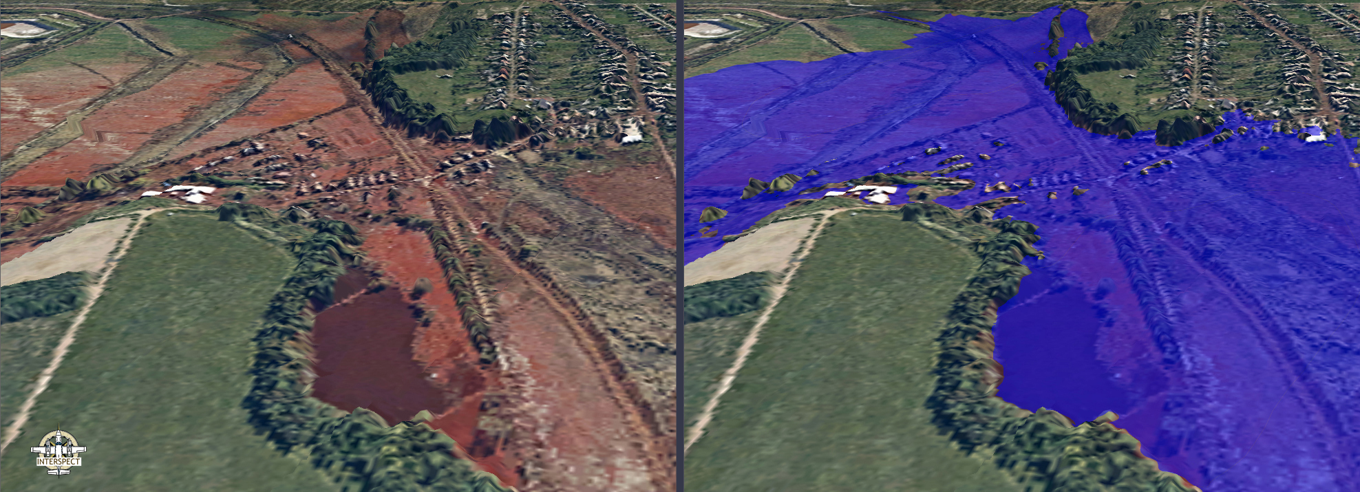
Mapping inundations observed during peak flood stages is crucial for avoiding future damages, verifying predictive models, and supporting insurance claims.
Mapping, management, and drainage of flood inundations and areas affected by inland excess water require spatial datasets. Effective inland excess water defense (preventive activity) and flood mitigation operations (damage control activity) necessitate the mapping of inland excess water inundations across large areas, which in such cases is most efficiently resolved using remote sensing methods. (Beyond being time-consuming and costly, field-surveyed inland excess water maps entail numerous potential errors. The primary reasons for this are difficulties in accessing specific terrain parts, limited line-of-sight visibility, and high susceptibility to variance in accuracy and level of detail depending on the surveyor (Licskó, 2005).) For instance, knowing areas vulnerable to inland excess water is indispensable as a basis for lowland amelioration works; therefore, airborne remote sensing surveys of such areas have a long-standing tradition in our country.
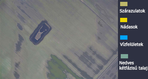
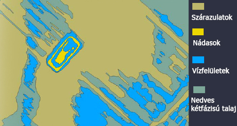
Advanced flood inundation mapping can be implemented through various remote sensing techniques, among which digital high-resolution aerial surveying occupies an increasingly significant role due to its operational speed and spatial detail. In the period elapsed since the previous aerial survey campaign, an aerial remote sensing acquisition procedure with a spatial resolution nearly tenfold higher than before has been developed through the combined deployment of state-of-the-art sensors, optics, and auxiliary equipment, alongside the creation of advanced precision airborne navigation systems. This methodology enables the separation of significantly more land cover categories than previously possible, while substantially improving recognition and boundary delineation accuracy through the generation of high-image-quality, high-detail orthomosaics. The development of this method was primarily underpinned by next-generation, high-sensitivity sensors and high-purity, high-resolving-power optical systems meeting increased resolution requirements.
This technological advancement yielded image quality and spatial detail that provide a viable alternative to costlier hyperspectral methods for the following land cover categories: dry soil surfaces, moist soil surfaces, saturated (two-phase) soil patches, open water bodies, and emergent aquatic vegetation. Additional land cover categories vary by geographic region and the precise mapping objectives. These true-color photomosaics are more economically accessible than hyperspectral datasets, which invariably feature much lower spatial resolutions. They are equally effective for flood inundation mapping. Previously, we simultaneously acquired near-infrared and true-color aerial imagery (with a ground sampling distance of 20 - 50 cm), but today, analyzing high-resolution (1-20 cm), wide dynamic range, minimum-noise true-color imagery yields satisfactory results. Nevertheless, multispectral technology remains available while complying with updated quality standards. Enhanced geometric and radiometric resolution also enables the detection of environmental contamination. In such cases, the type and extent of pollution can be estimated, though this must be verified through in-situ ground sampling and analytical measurements.
Mapping hydraulic engineering structures, river reaches, and flood overflows is similarly performed by processing raw data derived from airborne remote sensing surveys.
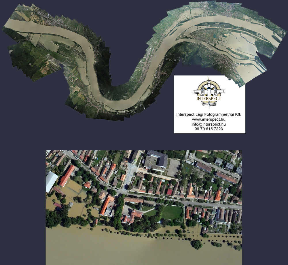
During high-water stages, the exposure and structural condition of hydraulic structures can also be inspected. The rapid execution of river reach mapping during high-water events can only be ensured via airborne remote sensing methods, as it enables the surveying of peak flood stages nearly concurrently. The imagery thus acquired effectively complements in-situ discharge measurements and water level gauge data.
Aerial maps captured during low-flow conditions can be utilized to estimate river water clarity; furthermore, they facilitate the generation of floodplain vegetation maps by accurately delineating boundaries between distinct plant associations. Regularly conducted surveys assist in understanding correlations related to river stage fluctuations, floodplain ecology, and water purity, supporting the development of appropriate floodplain management practices.
Gábor Bakó, Interspect Ltd.
Béla Licskó, VITUKI Non-profit Ltd.
 Interspect