- 4 band (R; G; B; NIR) vertical axis recording
- 4 * 35 MP Oblique RGB
- Simultaneously Multispectral & 3D Mapping
- Mission Planner Software
- 3 band (R; G; NIR) vertical axis recording
- 36 MP
- Resolution: 7354 x 4898
- FOV across track: 40°
- Calibrated single frame camera for quick photogrammetry
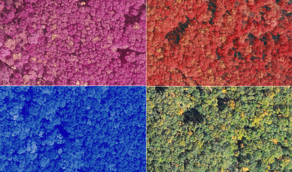
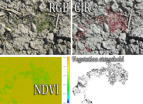
- For mapping vegetation health
- 10 cm GSD from 1000 m relative flight altitude with 650 m swath with
- Mission Planner Software
- 12 bands (NUV; R; G; B; NIR-1;
NIR-2 + 6 variable spectral bands)
- 25 MP resolution
- Resolution: 6200 x 4012
- FOV across track: 40°
- 10 cm GSD from 900 m (or 1450 m) relative flight altitude with 620 m swath width
- Variable spectral resolution
- High-speed image acquisition
- Mission Planner Software
for Photogrammetric and Geodetic surveys
Cost-effective solution for surveyors at geodetic, agricultural and map updateing applications
for quick vegetation and cropland surveys
Multispectral 3D Camera
for 3D vegetation surveys
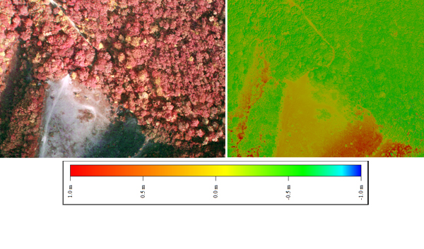
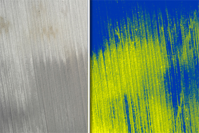
Dense point cloud with NDVI or other vegetation index values,
informations about the upper & lower canopy
Dense 3D surveys
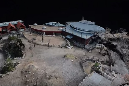
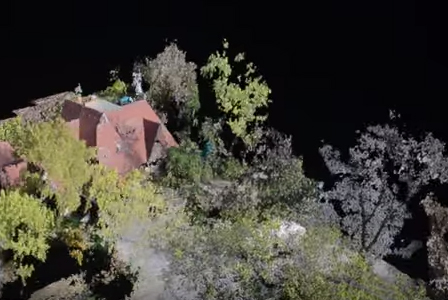
for building 3D City maps

- Single DSLR camera
- Calibrated 25 MP frame camera for photogrammetry
- Traditional mapping tasks
- Two-axis camera holder
with servo motor
- Mission Planner
- Weight: 0,7 kg
- PhotoScan Pro software

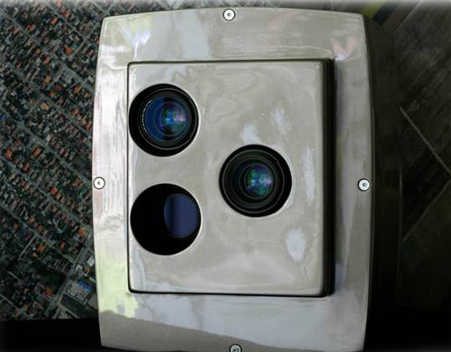
- INTERSPECT NDVI or RGB camera
- Calibrated 5 MP single frame camera for quick photogrammetry & vegetation survey
- For mapping wetlands, marshes, inaccessible places
- Two-axis camera holder
with servo motor
- Mission Planner
- Weight: 0,6 kg
- PhotoScan Pro software

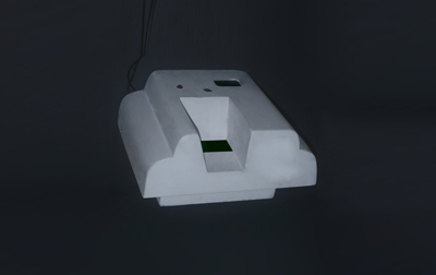
- INTERSPECT Forest Survey Camera (Complex MS - 3D system)
- 3D vegetation survey
- NDVI, Vi Green maps with corrections in the imaging system & dense 3D pointcloud
- Tracking System
- Calibration
- Mission Planner
Weight: 2,1 kg
- PhotoScan Pro software

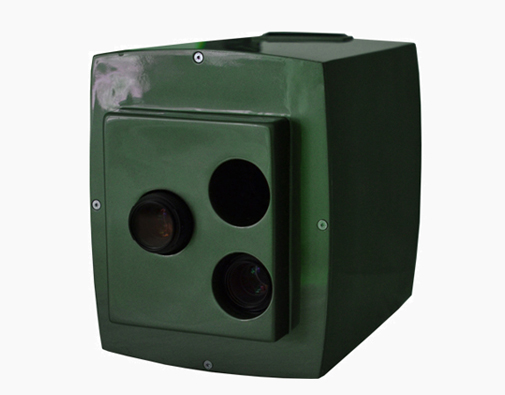
- INTERSPECT 3D Mapping Penta-Camera System
- 3D measurement technology
- 3D City, Dense 3D point cloud of the surface and the objects
- Tracking System
- Calibration
- Mission Planner
- Weight: 2,1 kg
- PhotoScan Pro software
for Precision Agriculture
- Mapping for the precise dosing of nutrients and chemicals
for Precision Agriculture
- Mapping for the precise dosing of nutrients
- Defining management zones for precision agriculture
Multispectral
Aerial Camera System
- GSD: 1 - 100 cm
-Resolution: 6000 x 4000
- 24 MP
- 0.6 µ
- 6 spactral bands
R; G; B; NIR-1; NIR-2; NIR-3
- Bit Depth: 14-bits
- High-speed image acquisition
- Dimebsions: 370 x 300 x 210 mm
- For Nature Conservation and Scientific Research
High spatial resolution
Multispectral Aerial Camera System
GSD: 1 - 100 cm
- Resolution: 7354 x 4898
- 10 MP
- 0.6 µ
- 6 spactral bands
NUV; R; G; B; NIR-1; NIR-2
- Bit Depth: 14-bits
- High-speed image acquisition
- Dimebsions: 388 x 310 x 470 mm
- For Nature Conservation and Scientific Research
- Vegetation mapping
- Forest management
- Forest damage mapping
- Localization of infections and insect pests
- For Water Management
- Contamination detection
Extreme high spatial resolution
Multispectral Aerial Camera System
GSD: 0,5 - 100 cm
-Resolution: 7354 x 4898
- 36 MP
- 0.48 µ
- 6 spactral bands
NUV; R; G; B; NIR-1; NIR-2
- Bit Depth: 14-bits
- High-speed image acquisition
- Dimebsions: 388 x 310 x 470 mm
- For Nature Conservation and Scientific Research
- Colony Mapping
- Vegetation mapping
- Forest management
- Forest damage mapping
- Surveys for national parks and conservation areas
- Mapping the invasive plant species
High Resolution Aerial Camera System for Cadastral Mapping
GSD: 4 - 50 cm
- Resolution: 15811 x 11713
- 185 MP
- 0.6 µ
- 3 spactral bands
- Spectral Resolution: RGB
- Bit Depth: 14-bits
- High Resolution Photogrammetry
- Dimebsions: 520 x 410 x 310 mm