
The Interspect Ltd. primarily produces aerial ortho image maps by RGB, MS or HS remote sensing and develops airborne instruments.
Aerial Surveys for Water Management
Inland Water Mapping by High Resolution Aerial Remote Sensing
Ortho image mosaic and digital terrain modell
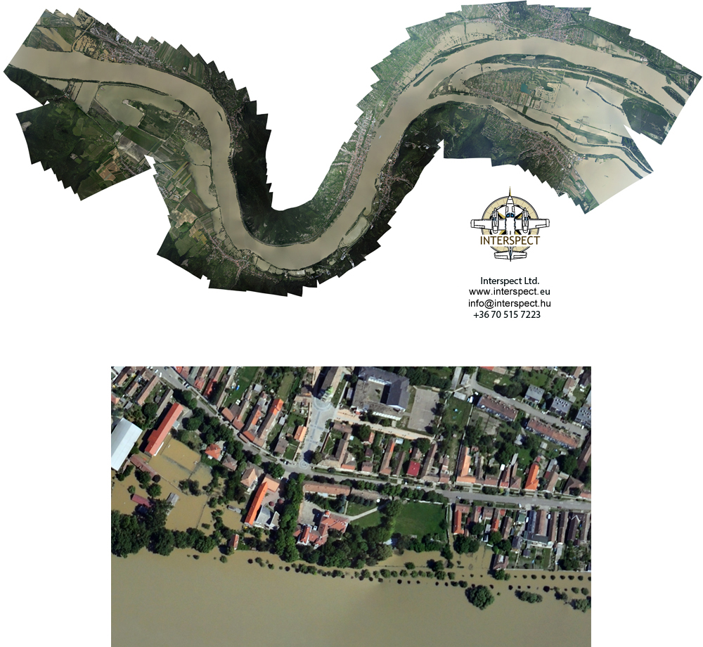
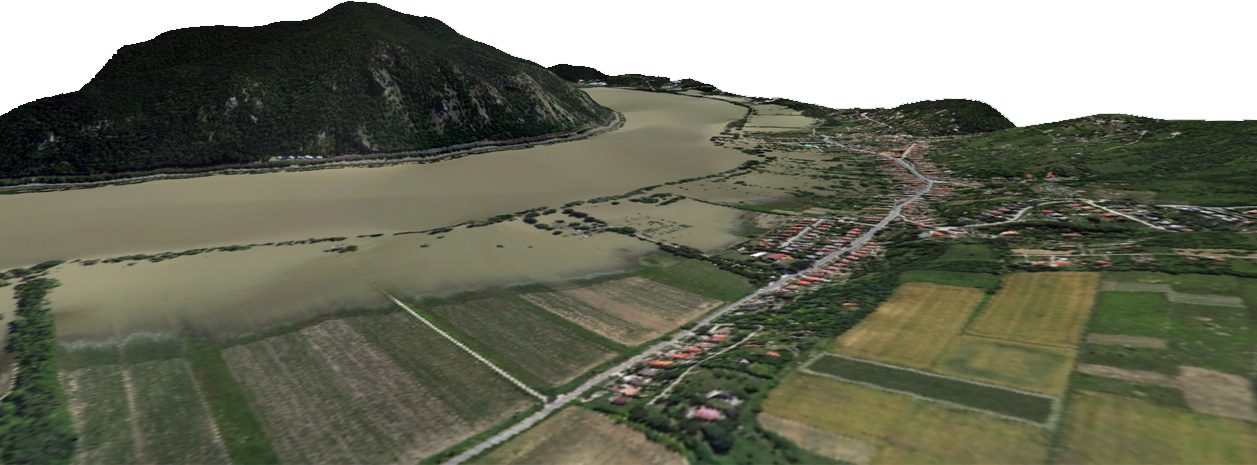
Aerial survey of flood (Danube)
Surface heat mapping of water bodies
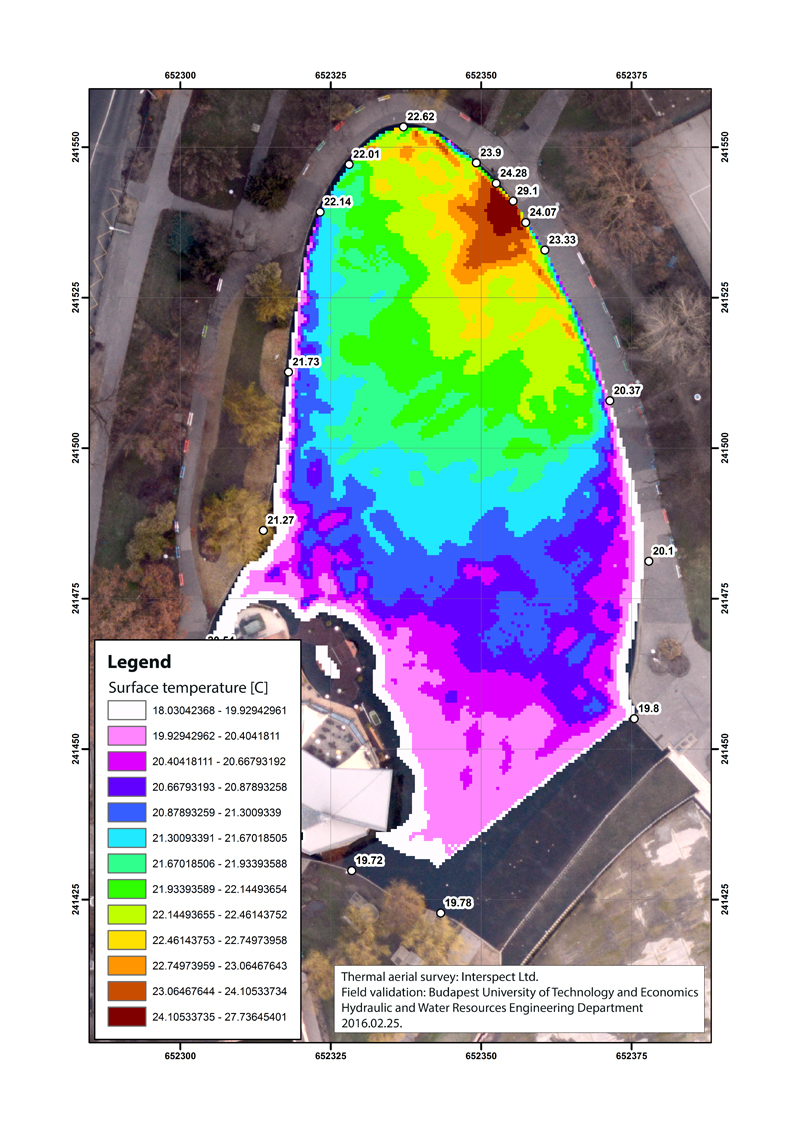
Thermal map of a lake (Budapest, Hungary)
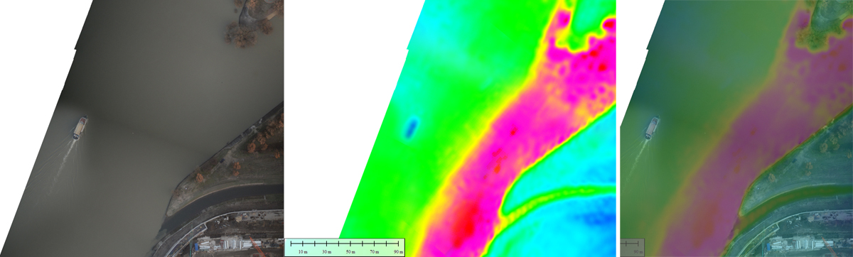 "
"Part of the thermal map of a warm-water river bed outflow in Danube riwer (Budapest, Hungary)
More information: Rapid Aerial Mapping Methods for Water Management - GEO Informatics Vol.17 2014. Jan/Febr. p. 44-45 Molnár Zsolt, Bakó Gábor