Profile: Aerial surveys, interpretation of aerial images, thematic mapping, land cover maps, digitization, research and sensor development
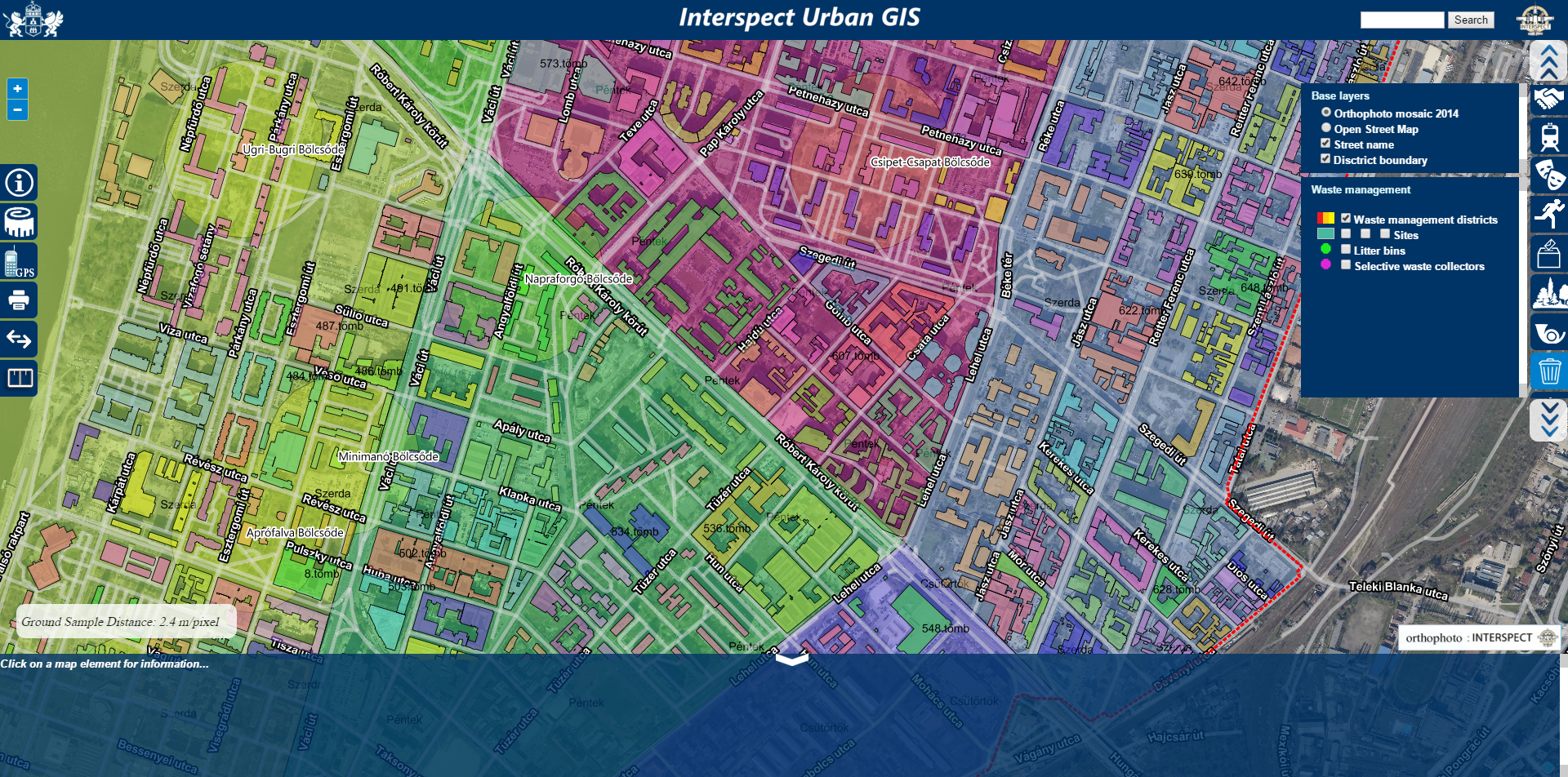
GIS Solutions for Urban and Regional Planning,City GIS in the cloud, web GIS for public information
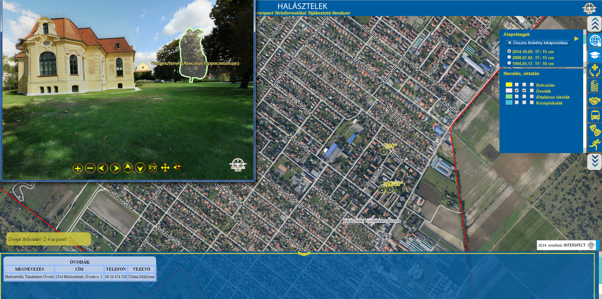
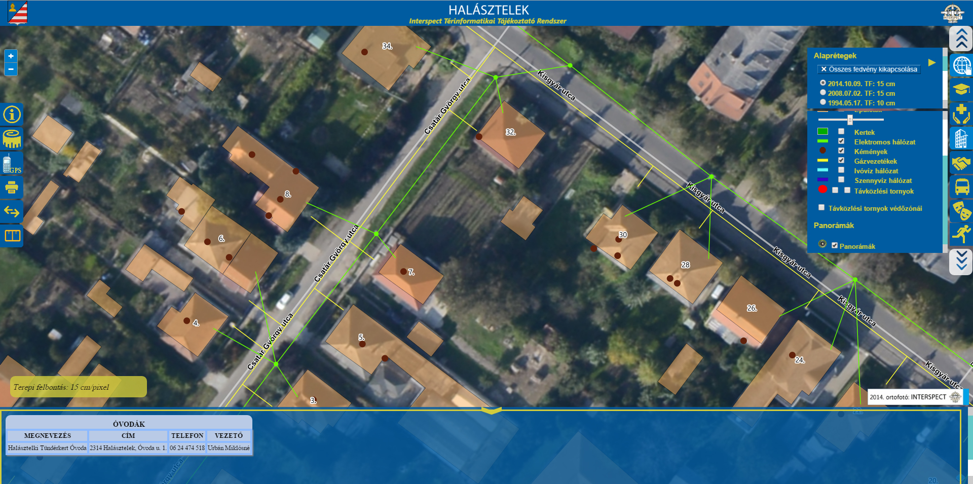
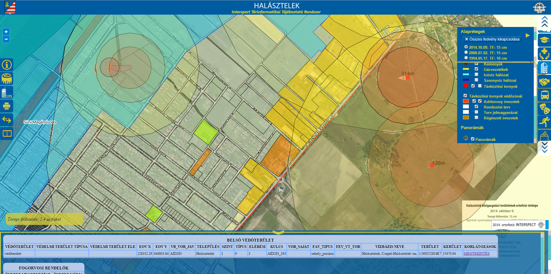
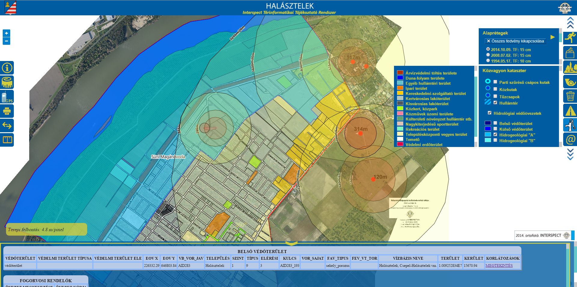
Urban planning requires including many layers of detail on a single map, and one of the features of a GIS is multilayered mapping. Each of these layers has different types of information and data associated with it. A municipal planning committee can use a GIS to see a variety of different things, including Education, Health, social care, Public institutions, Waste management, Real estates, Culture, Entertainment, Sport oportunities, Landscapes, Roads, Pavements, Utilities, Cadastre. You can compare orthophotos and vector data, analyze, search, query, convert coordinates, measure, print map with statistics.